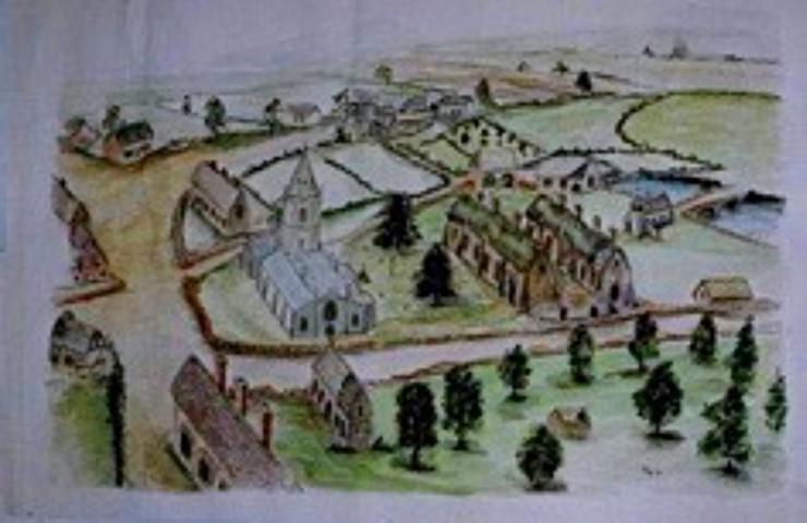
St Bartholomew’s, Tong
Discovering Tong
Old Maps of Tong
Notable changes in the maps
Hubbal, Meashill and Tong Park
The east-centre part of the parish show little change in the Durant era. Hubball Farm was the Grange for Black Ladies Priory to the East and was one of the main farms in the parish in the period up to 1765. Park Farm had recently been ‘disparked’ and so the fields were comparatively large already. Some combination of smaller fields is evident. These farms represent the main farmland in 1765.
The making of the Offoxey Road
The straightness of Offoxey Road can lead one to think it is a Roman road. It is certainly straight and ignores the contours. This was however, Durant’s work and a major reshaping of this part of the parish.
The 1765 map shows a track leading West from Bishops Wood skirting the parish boundary before emerging into Tong Knoll ‘common’ land but the main East-West track at this time was Hubbal Lane. It is joined by a track from Hubbal running north which has completely disappeared. At Tong Norton there was a bit of a track heading East but the main track ran NE into Tong Knoll.
Not only was the line of Offoxey road new (not following any field boundaries) but the fields to the north and south were completely remodelled as well. This seems an excessive amount of effort for little economic return. I can only think that the loss of Tong Knoll to Weston Park had something to do with it, perhaps the Earl of Bradford was persuaded to pay for the new road as part of the deal as losing the Knoll would mean losing the northern trackway to the Holt.
Tong
If you look at ‘Friar’s Lane’ from Tong to Tong Norton in 1765, it then followed a sinuous course. Originally I wondered if this was cartographer’s licence, but the change of route is confirmed in the aerial photograph where you can see a few ghosts of the old course. I can’t think of an obvious reason why Durant needed to do this, may be the making of the Church Pool required this but in some places it has been brought closer to the stream, perhaps it was just too narrow. Many of the smallholdings to the south-east of the village were combined at some stage. Note that ‘Church Farm’ is called ‘Inn Farm’ confirming the location of the old Bell Inn opposite the Church.
Vauxhall
To make the Lodge Lake required the water course from Norton to hug the contours and this probably meant the Shifnal Road had to be moved North. The change of position is confirmed by the unaltered pattern of fields to the North. The original Shifnal road came out by the Church just by the ‘Hospital’ (Infirmary) this makes a lot more sense than its current junction placement. The whole Old Worcester Road is moved to the West away from the Castle. The northern displacement of the road continues all the way to Timlet (Timplet) Bridge.
Ruckley
The Ruckley estate seems to have been substantially remodelled during this time with the building of the main house and Ruckleywood Farm as well as the railway.
Havannah
The 1765 maps shows an open area ‘Norton Heath’ between Norton and Lizard Farms and this must have been enclosed in the Durant time. Lack of map information precludes more comment.
The Castle
The changes to the Kingston mansion at Tong Castle is quite amazing. The original Tong Mill was drowned under the Church Pool when Durant landscaped the Estate. Tong’s original Mill pond was deepened and extended. There was also a direct drive to Tong Park and the main Kingston castle entrance was nearly exactly where the present bye-pass meets the old road. The Durant/Capability Brown landscaping included the planting of Castle Wood to obscure the view to the Castle except from the Church Pool track. Now the M54 cuts through it all.
Looking back before 1765
Without prior detailed map evidence this can be no more than a conjecture.
At the time of the Vernons the amount of cultivated land was more constricted with a large area of woodland to the West (as evidenced by Wood Farm and Tong Rough) and open land to the north of Tong Norton. The main farmed area was near to flowing water (Hubbal Grange, Lizard Grange and Tong Norton).
The use of water power for milling and forging had a great impact as the water drop in the steep stream ravines is providential, making creation of mill races with a good head of water easy. The Mill at Tong would have been as important as those at Tong Forge and Lizardmill.
Landscaping and the gradual silting up of the northern Church Pool gives the impression of a shallow valley but it is likely that this would have been as deep a ‘ravine’ as now at Tong Forge and this would have formed the main Western boundary to the main village. The early village is most likely to have developed on the East side of the valley along old Friar’s Lane up to Castle Hill at Tong Norton. An interesting area of crop marks is evident in the area of the old trackway north of Hubbal and I wonder if this is where the village’s original Tithe Barn may have been.
White Oak
The fields have changed little, some have been combined, a few fields have been restored back to woodland.
M54
The M54 was built in the 1980s to connect Telford with the M6 and Birmingham. The line takes it along the south of the parish but cuts directly through the middle of the site of Tong Castle. The junction with the A41 takes a fair bit of space.
Ornamental Pools
The Lodge Lake was a very shallow pool and soon silted up, it was converted into part of Vauxhall Farm. The dam for South Pool gave way about 1890 and was not repaired. However this still leaves Norton Mere; Church Pool; Ruckley Pool and Neachley Pool.
Pickmere Island
The junction between the busy A5 and A41 became an island in the 1960s. Many of the small fields around Tong Havannah have been combined. The farm at Tong Havannah has become part of a neighbouring farm.
Note this material is not included in the book.
This page: Copyright © 2007 through 2022 Discovering Tong

To find out more about Tong please buy a copy of the Discovering Tong book;
the profits from the sale of the book go towards maintaining Tong Church.
Would You Like To Support Us?
The Tong Vision for 2020 and beyond has a target to raise £500,000 over the next 3 years in order to fund urgent and
essential restoration work, and to ensure that all visitors and congregations can continue to enjoy this unique building!
If you can offer your support either financially, in-kind or otherwise, please contact us or visit our JustGiving page by clicking the image, below.

A big thank you to all our supporters! Particular thanks go to the following:

To view details of our charitable status please click here
